This is an archive section with links to former Expert Groups (EGs) and Action Groups (AGs) which have finished. For groups which ended before 2014, please see the original archived website. For former Research Programmes, see Former SRPs.

Former Groups
ACCE
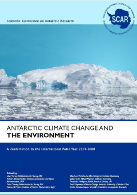
The study of Antarctica and the Southern Ocean and their role in the global Earth system has never been more important as the region is experiencing dramatic changes that have global implications. The climatic, physical and biological properties of Antarctica and the Southern Ocean are closely coupled to other parts of the global environment by the oceans and the atmosphere. In 2009, SCAR published the landmark Antarctic Climate Change and the Environment Report. In 2022, the Antarctic Climate Change and the Environment: A Decadal Synopsis and Recommendations for Action was published.
The Expert Group on Antarctic Climate Change and the Environment acted as an umbrella for SCAR activities and produced the yearly update to the ACCE report.
Background
The Antarctic continent and Southern Ocean are extremely important parts of the global physical/biological system, linked to the rest of the Earth in often highly non-linear ways. Research has shown that to understand how planet Earth works we need to study it increasingly as a system, and understand the lithosphere, the hydrosphere, the cryosphere, the biosphere and the atmosphere. One of the remotest parts of the Earth system is Antarctica, a continent larger than either Australia or Europe. We will not be able to fully understand how the Earth system works without comprehensive knowledge of the physical, biological, chemical and geological processes taking place within and above Antarctica and its surrounding Southern Ocean. That is a huge challenge given that these processes take place among some of the remotest and harshest environments anywhere on the Earth’s surface.
Much has been achieved in acquiring knowledge of Antarctica’s physical, biological, chemical and geological processes, especially since a network of permanent scientific stations was established for the first time on the continent during the International Geophysical Year of 1957-58. Many more results also emerged from the International Polar Year of 2007-2008.
With the increasing emphasis on cross-disciplinary Antarctic studies in the early years of this century, SCAR started a series of regular meetings that focussed of developing better links between those working in the physical and biological sciences. Out of this grew an initiative that became known as Antarctic Climate Change and the Environment (ACCE), which was seem as a southern counterpart to the Arctic Climate Impact Assessment (ACIA). The goal was to prepare a volume that reviewed our present understanding of the physical and chemical climate system of the Antarctic region, the way it varies through time, and the profound influence of that variation on life on land and in the ocean around the continent. It would also examine predictions of how the system would evolve over the next century under conditions of increasing concentrations of greenhouse gases and recovery of the ozone hole.
Inputs were obtained through a process of open consultation with the wider community in which scientists affiliated with SCAR or known to be active in climate and environmental sciences in Antarctica or the Southern Ocean were asked for text on key topics. A first draft was then circulated to the wider community for comment in June 2008. The Editorial Board then modified the text for a second round of open consultation in March 2009. Parties to the Antarctic Treaty, representatives of the Commission for the Conservation of Antarctic Marine Living Resources (CCAMLR), and representatives of the Council of Managers of National Antarctic Programmes (COMNAP) were also asked for input. Eventually over 100 scientists from various fields contributed to the volume, which was published in 2009 as Antarctic Climate Change and the Environment. They are listed alphabetically as authors of the appropriate chapters after the chapter editor.
Five hundred copies of the volume were published and distributed widely to the Antarctic community and beyond. In addition, individual downloadable chapters were made available on the SCAR website, so as to encourage its widespread use as a research and teaching resource. The volume was a contribution to the International Polar Year 2007-2008 and to the goals of the World Climate Research Programme (WCRP), and in particular to its Climate and Cryosphere programme (CliC), of which SCAR is a co-sponsor. It was also made available to attendees at the meeting of the UN Framework Convention on Climate Change in Copenhagen in December 2009, and subsequently to the Intergovernmental Panel on Climate Change. Brief, annual updates on advances in Antarctic climate-related science were also provided to the Antarctic Treaty Consultative Meetings. However, Antarctic science is advancing very rapidly with important papers regularly being reported in the popular press. It was therefore felt that a revision to the original ACCE volume would be appropriate. But rather than produce another hardcopy book it was decided to convert the original material into a wiki so as to make it easier to revise the text.
The preparation of the ACCE wiki was carried out by Mr Tony Phillips and Mr Guy Phillips using the open source Mediawiki software. We are grateful to the British Antarctic Survey for hosting the wiki.
ANGWIN
The Antarctic Gravity Wave Instrument Network (ANGWIN) was a SCAR Action Group from 2018 to 2024. It was a scientist-driven initiative focused on building a collaborative network of Antarctic gravity wave observatories. The project aimed to enhance understanding of gravity wave activity over Antarctica and its influence on global circulation by utilizing observatories at existing Antarctic research stations.
Initially started with a focus on mesospheric airglow observations, ANGWIN expanded to include all gravity wave instrumentation. By fostering international collaboration, standardizing analysis methods, and combining resources, ANGWIN worked to address the need for comprehensive, continent-wide observations of gravity waves across all atmospheric levels.
The primary objectives of the network were to:
- Quantify the longitudinal variation in gravity wave activity from the lower atmosphere into the mesosphere and lower thermosphere above Antarctica, and determine causes.
- Characterise the propagation and dynamical influence of mountain waves on stratosphere and MLT dynamics.
- Relate gravity waves observed in the stratosphere, mesosphere and thermosphere to sources such as storms in the Drake’s Passage and Southern Ocean, auroral activity or the polar vortex.
- Study the interaction of gravity waves with global scale waves and their contribution to the polar vortex dynamical and thermal structure.
- Compare observed polar gravity wave characteristics to parameterized gravity waves in climate models.
- Determine the potential effects of Antarctic gravity waves on processes such as polar stratospheric cloud formation.
ANGWIN was chaired by Tracy Moffat-Griffin (British Antarctic Survey, UK). Other members of the group included:
- Mitsumu K. Ejiri (National Institute of Polar Research, Japan)
- Geonhwa Jee (Korea Polar Research Institute, Republic of Korea
- Damian Murphy (Australian Antarctic Division, Australia)
- Takuji Nakamura (National Institute of Polar Research, Japan)
- Mike Taylor (Utah State University, USA)
- Jose Valentin Bageston (Instituto Nacional de Pesquisas Espaciais (INPE), Brazil)
CGG
The SCAR Connecting Geophysics with Geology (CGG) was a SCAR Action Group that aimed to identify highest-priority areas where lineaments and/or apparent tectonic block boundaries intersect with outcrops, provide improved geological maps, improve connections to adjacent continents within Gondwana/Rodinia and project the knowledge of these into Antarctica, and identify worthy drill sites for basement recovery and connect to other Antarctic drilling communities.
The aims and objectives of the group were to:
- Identify highest priority areas where lineaments and/or apparent tectonic block boundaries intersect with outcrops
- Coordinate and develop multinational capabilities in geophysics and geology
- Plan and initiate international expeditions to key areas
- Provide improved geological maps, specifically in logistically demanding areas
- Improve connections to adjacent continents within Gondwana/Rodinia and project the knowledge of these into Antarctica
- Identify worthy drill sites for basement recovery and connect to other Antarctic drilling communities
The CGG Action Group noted key areas that required detailed geological fieldwork and targeted geophysical studies to understand significant geophysical lineaments and tectonic boundaries, with many regions still unmapped. It was noted that systematic aerogeophysical surveys were beginning to uncover sub-ice geology across the continent.
One key area for unravelling the geodynamic evolution of East Antarctica had been identified in central Dronning Maud Land, where the major Forster Magnetic Anomaly, a possible suture zone, appeared to dissect the Dronning Maud Land mountains. The aerogeophysics of this key region was being improved as a joint AWI-BGR effort. The action group had strong links to IGCP 648: Supercontinent Cycles & Global Geodynamics and had cross-link interest with the ADMAP Expert Group.
In 2024, with the approval of the Antarctic Geospace and ATmosphere reseArch (AGATA) as SCAR’s new Scientific Research Programme (SRP), the CGG was merged into the new AGATA SRP.
CGG was jointly chaired by:
- Joachim Jacobs (University of Bergen and Norwegian Polar Institute, Norway)
- Fausto Ferraccioli (Istituto Nazionale di Oceanografia e di Geofisica Sperimentale (OGS), Italy)
- Andreas Läufer (Federal Institute for Geosciences and Natural Resources (BGR), Germany)
ECA - Environmental Contamination in Antarctica
The action group on Environmental Contamination in Antarctica (ECA) ended in 2014.
During the SCAR Conference held in St Petersburg in June 2008, the Standing Scientific Group on Physical Sciences agreed to continue ECA. During the same meeting the 2nd ECA workshop took place; there, the data collected by the groups formed during the 1st workshop (held in Venice) were presented and discussed.
The following priorities were identified for future activities:
- to support the integration of the ECA data base in the JCADM by construction of one dedicated portal;
- to recognize and separate local sources (bases, aircrafts, ships, traverses) from global contaminant signatures by identifying proxies of the potential sources. In this activity, the national individuals/officers responsible for the application of the Madrid protocol relevant to environmental impact monitoring of the logistic and scientific activities should be involved;
- to optimize the use of samples collected for environmental characterization purposes and warranty reliable data by:
- defining the role of specimen banks (international collaboration);
- organizing proficiency tests for trace contaminant determination in environmental matrices which should take into account the possibility of preparing specific Antarctic reference materials;
- to organize the 3rd ECA workshop aimed at:
- completing datasets for environmental contaminants;
- identifying gaps in the existing data;
- defining topics for joint research projects on environmental contamination in Antarctica.
The 3rd ECA workshop took place in Venice from 22-23 June 2009. The programme presented contributions from scientists involved in programmes dealing with ECA and studying the transport of micro-components and pollutants in polar regions.
The main aims of the ECA group were:
- Analysis and comparison of national research projects.
- Coordination of studies on the Environmental Contamination in Polar Regions.
- To identify new research subjects for a better understanding and analysis of Environment Contamination on a global scale.
- Start up and implementation of an international program on the Environmental Contamination in Polar Regions
EOAG
The Earth Observation Action Group (EOAG) was a SCAR Action Group from 2018 to 2024. EOAG aimed to be a permanent advocate for the acquisition of all types of satellite data over the Antarctic and Southern Ocean region (up to 60° S) from multiple space agencies, recommending the type of satellite observations needed to measure Essential Climate Variables (ECV’s) relevant to the Polar regions, and recommending how best to preserve the long term continuity of satellite Earth Observation data records.
Objectives
The objectives of EOAG were to:
- Be a permanent advocate for acquiring all types of satellite data over the Antarctic and Southern Ocean region (up to 60° S) from multiple space agencies, as was successfully done in the International Polar Year (IPY).
- Make recommendations about the type and accuracy of satellite observations required in order to measure Essential Climate Variables (ECV’s) relevant to the Polar Regions.
- Identify a program of grand science challenges which can best be tackled with Earth Observation data.
- Advocate for and make recommendations about how best to preserve the long term continuity of satellite Earth Observation data records.
EOAG was chaired by Anna Hogg (University of Leeds, UK). Committee Members of the group included:
- Helen Fricker (University of Leeds, UK)
- Ian Joughin (University of Washington, USA)
- Stefan Hendricks (Alfred Wegener Institute (AWI), Germany)
- Ted Scambos (National Snow and Ice Data Center (NSIDC), USA)
- Matthew England (University of New South Wales, Australia)
- Michel Van Roozendael (Belgian Institute for Space Aeronomy, Belgium)
- Tamsin Edwards (Kings College London, UK)
- Chris Banks (National Oceanography Centre (NOC), UK)
Other representatives from existing SCAR groups included:
- Rene Forsberg (Danish Technical University (DTU), Denmark)
- Matthew A. Lazzara (University of Wisconsin-Madison, USA)
In 2021, the Remote Sensing group merged with the Earth Observation group. The EOAG group completed its work in 2024.
Geomap
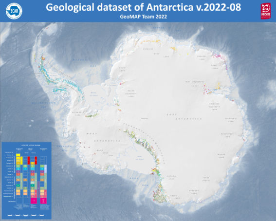
The SCAR GeoMAP (Geological Mapping Update of Antarctica) action group was an international effort to gather both rock and surficial deposit information and compile it into a modern GIS framework. The group ended in 2020, having met its aim with the release of an initial draft geological dataset v.2019-07, but GNS Science has continued working and improving these data (latest release v.2022-08). More information can be found on the GeoMAP resource page.
The group was led by Simon Cox and Paul Morin, with help from many other people and organisations (view the list of members, collaborators and supporters from 2019). Work started from a continent-scale, low density, attribute-poor dataset in 2015 that was added to and improved through multiple iterations during 2018-2022. It involved capturing existing geological map data, refining its spatial reliability, then improving representation of glacial sequences and geomorphology. GeoMAP depicts ‘known geology’ of rock exposures rather than ‘interpreted’ sub-ice features and is aimed towards continent-wide perspectives and cross-discipline interrogation.
- Access the GeoMAP Download Page
- Access GeoMAP Metadata
GeoMAP material is licensed under a Creative Commons Attribution 4.0 International License. The following citation for GeoMAP.v.2022-08 is suggested:
Cox, Simon Christopher; Smith Lyttle, Belinda; Elkind, Samuel; Smith Siddoway, Christine; Morin, Paul; Capponi, Giovanni; Abu-Alam, Tamer; Ballinger, Matilda; Bamber, Lauren; Kitchener, Brett; Lelli, Luigi; Mawson, Jasmine F; Millikin, Alexie; Dal Seno, Nicola; Whitburn, Louis; White, Tristan; Burton-Johnson, Alex; Crispini, Laura; Elliot, David; Elvevold, Synnove; Goodge, John W; Halpin, Jacqueline A; Jacobs, Joachim; Mikhalsky, Eugene; Martin, Adam P; Morgan, Fraser; Smellie, John; Scadden, Phil; Wilson, Gary (2023): The GeoMAP (v.2022-08) continent-wide detailed geological dataset of Antarctica. PANGAEA, https://doi.org/10.1594/PANGAEA.951482
A GeoMAP web-based explorer can be accessed directly through Antarctic Explorer.
Access detailed GeoMAP documentation
 Following publication of the
 GRAPE
The GNSS (Global Navigation Satellite System) Research and Application for Polar Environment (GRAPE) aimed to build and coordinate a robust network of international collaborations to address a variety of weather and space weather related needs at high latitudes and the polar regions (Arctic and Antarctica), through ad hoc data sharing and models development. Its work has been absorbed into the Antarctic Geospace and ATmosphere reseArch (AGATA) programme planning group.
Background
Built on the SCAR Action Group GPS for Weather and Space Weather Forecasting (GWSWF) and taking advantage of the Interhemispheric Conjugacy Effects in Solar-Terrestrial and Aeronomy Research (ICESTAR) experience, the GRAPE Expert Group continued efforts to build and coordinate a robust network of collaborations in order to answer a variety of space-weather-related needs through ad hoc data sharing and model development.
GRAPE was based on the use of the classical GPS POLENET array and the growing coverage of modern GNSS systems, on the availability of advanced modelling and on the opportunity offered by the advancing solar cycle.
Further details are on the external GRAPE website.
Terms of Reference
The main objectives of GRAPE were to:
- Create and maintain distributed networks of specialized GPS/GNSS Ionospheric Scintillation and TEC Monitors particularly at high latitudes;
- Identify and quantify mechanisms that cause scintillation and control interhemispheric differences, asymmetries and commonalities in scintillation occurrence and intensity as a result of the geospace environment conditions;
- Develop ionospheric scintillation climatology, tracking and mitigation models to improve prediction capabilities of space weather;
- Retrieve tropospheric PWV for input to weather forecast models and to develop regional PWV climatology for atmospheric sensing in remote areas.
How GRAPE worked
GRAPE was arranged into five work packages:
- S-T interactions and ionospheric effects in the current solar-cycle;
– Multi-instruments investigation of the upper atmosphere plasma dynamics and scintillation generation (SuperDARN, GNSS, ionosondes, VLF, etc.)
– Scintillation climatology, TEC fluctuations, structure scale, C/N statistics, etc. - Lower atmosphere delay in GNSS based systems (water vapor reconstruction, etc.);
- Modelling and models testing;
- Data management strategy;
- Coordination with other programmes inside and outside SCAR (e.g. URSI, CAWSES II, SuperDARN, EISCAT 3D)
Data
GRAPE focused in particular on GNSS high sampling rate (50 Hz) receivers network at bipolar latitudes. Information on raw data and related products [Total Electron Content (TEC), scintillation indices, Rate of TEC (ROT), etc.] are available at:
- INGV’s Electronic Space Weather Upper Atmosphere, Italy: www.eswua.ingv.it
- GNSS Group, Belgium: gnss.be
- Madrigal Database: cedar.openmadrigal.org/openmadrigal/
- Canadian High Arctic Ionospheric Network: chain.physics.unb.ca/chain/
- South African National Space Agency: www.sansa.org.za/
SANSA Geomagnetic data: spaceweather.sansa.org.za – geomagnetic-data
Membership
The GRAPE group was led by Giorgiana De Franceschi (Chair) and Nicolas Bergeot (Deputy Chair).
See the list of members for more information on participating institutes and researchers.
Publications
A list of selected publications by GRAPE members in journals and conference proceedings from 2012 to 2022.
Earlier GRAPE and GWSWF publications are available to view and download from the Resources section of the external GRAPE website.
HASSEG
 What was HASSEG?
The SCAR Humanities and Social Sciences Expert Group (HASSEG) aimed to bring together researchers in the humanities and social sciences with an interest in the Antarctic region. The group facilitated the exchange of news, publications and research ideas, held regular conferences and workshops, and organized research projects around different topics – the first was the Values Project – “Exploring Antarctic Values”.
Values Project
“Values in Antarctica: Human Connections to a Continent”
HASSEG’s main focus during the period 2010-2014 was on:
- Cataloguing the range of human values associated with the southern polar continent, including both intrinsic values (such as symbolic and spiritual) and extrinsic values (such as economic and scientific), and
- Studying the ways in which these values may have an impact on the level and nature of human activity in Antarctica.
The group focused their work on these aspects as the balancing of Antarctic values influences a wide range of decisions. Some of these decisions are limited to a local impact, while others may affect entire global systems, primarily via their effects on climate, culture, and international policy. Thus, understanding the extent and nature of the values that human beings place on Antarctica has large-scale and very serious implications.
Although recognising that more work needed to be done in this regard, the group was able to lay a solid foundation upon which to build with future values-related research. The 2013 keystone publication “Exploring Antarctic Values” provides a good overview of the issues the work covered.
While the values project continued to play an important role in their research, their recognition as a SCAR Expert Group at the 2014 SCAR Delegates Meeting in Auckland, New Zealand, offered an opportunity to broaden their research agenda and include a wider range of projects that addressed current issues (including climate change, governance, environmental management, human engagement with Antarctica) from a humanities and social sciences perspective.
Institutional History and Structure
HASSEG was formed as an Action Group under the umbrella of SCAR in 2010 by a group of international scholars, with the aim of fostering new approaches to Antarctic research grounded in the humanities and social sciences. In 2014, it became a SCAR Expert Group.
The core group of experts that formed the group in 2010 was expanded over time to ensure a wide geographical and disciplinary representation. This core group assumed the role of a steering group, providing the leadership and strategic direction for HASSEG and responsibility for reporting to SCAR. Leadership of the group was kept dynamic – Dr Daniela Liggett was co-chair from the group’s inception and was joined as co-chair by Dr Gary Steel (2010-12), Dr Juan Francisco Salazar, (2012-14) and finally by Prof Elizabeth Leane (from early 2015).
In 2018, HASSEG joined with the History Expert Group to become the Standing Committee on the Humanities and Social Sciences (SC-HASS).
Terms of Reference for HASSEG were:
- To facilitate exchange between researchers in the humanities and social sciences interested in the Antarctic region and build a community of Antarctic humanities scholars and social scientists;
- To increase the transparency around Antarctic-related humanities and social sciences research;
- To identify and progress group research projects (such as the “Exploring Antarctic Values” project); and
- To liaise with the SCAR Secretariat, Executive Committee and Delegates as well as other SCAR committees and research groups and provide advice and input where relevant and as requested.
History Group
The original aim of the History Action Group was to obtain insight into the development of how Antarctic research was institutionalized within SCAR. The goal was to study to what degree research in the Antarctic has been driven by scientific criteria and to what extent compromises were made in the light of political barriers and logistical limitations. It was the only group offering the unique opportunity of sharing archival work referring to Antarctic history with personal experiences of polar researchers from all continents. Membership was open to anyone interested in the history of Antarctic research – polar historians, historians, polar veterans, polar researchers and other scholars ranging from undergraduate students up to retired professors from all over the world.
The sharing of knowledge and ideas produces very lively and fruitful discussions. The History Group became an Expert Group in 2010, and acted as a meeting place for scholars working on the history of the Antarctic from diverse perspectives, with an overt focus on involving junior scholars and fostering collaboration among group members. The group held many workshops and its work contributed directly to the work of several PhD students. This work is continued through the Standing Committee on Humanities and Social Sciences.
To honour the work in history of polar research a speaker is chosen each year to give the Lewander Lecture during a workshop or conference.
History Group Workshops, from 2005 to 2012
- 1st Meeting of the History Action Group, Munich (Germany), 2005
- 2nd Meeting of SCAR History Action Group, Santiago (Chile), 2006
- 3rd Meeting of the SCAR History Action Group, Columbus (Ohio, USA), 2007
- 4th Meeting of the SCAR History Action Group, St. Petersburg (Russia), 2008
- 5th Meeting of SCAR History Action Group, Washington D.C. (USA), 2009
- SCAR History Action Group sessions in Buenos Aires and Oslo, 2010
- History Workshops in 2011
- 8th Meeting of SCAR History Expert Group, Portland (USA), 2012
From 2013, the History and Humanities and Social Sciences Groups met jointly. See the Humanities and Social Sciences Meetings page for more information.
Criteria for the selection of oral presentations during meetings
- The paper must conform to the session description.
- The paper must represent a novel contribution (for example new findings, sources, topics, methods or study areas) and be of a high academic standard.
- If criteria (1) and (2) are both met, further criteria regarding speakers will be applied:
- Age and previous experience. Early career scholars and those who have not previously taken part in a SCAR Open Science Conference should be given priority for an oral presentation.
- Gender. Female speakers must be represented.
- Language. Speakers from non-native English speaking countries must be represented.
- Applications for oral submissions that meet the eligibility criteria but cannot be accommodated in the main program will be offered a poster slot.”
Terms of Reference for the History Group were:
“The Expert Group will continue to act as a meeting place for scholars working on the history of the Antarctic from diverse perspectives, with an overt focus on involving junior scholars and fostering collaboration among Group members. The Expert Group’s meetings will also help facilitate the sharing of research materials, including newly-collected oral histories and newly-released archival sources. The geographical diversity of the Group’s membership will permit material from around the globe to be accessed, from North and South America to Africa, Australasia, Europe (eastern and western) and Russia.“
ICESTAR
The ICESTAR (Interhemispheric Conjugacy Effects in Solar Terrestrial and Aeronomy Research) Expert Group dealt with various geophysical and upper atmospheric phenomena developing either simultaneously over both the Northern and Southern polar regions (i.e., controlled by external forces and producing bi-polar effects) or connected through the interhemisphericgeomagnetically-conjugate coupling. The ICESTAR project began as a Scientific Research Programme, which ended in 2010.
The ICESTAR EG focused on identification and specification (quantification) of various mechanisms that control bi-polar regional differences or commonalities in the magnetosphere-ionosphere coupling and the corresponding upper atmospheric phenomena over both polar regions.These bi-polar (or interhemispherically conjugate features) might be intrinsic to the polar ionosphere and upper atmosphere or be caused by long-term or abrupt changes in the near-Earth electromagnetic environment forced by the solar activity. The aim was to improve understanding of concerted responses of both polar regions to electromagnetic variations and plasma dynamics in interplanetary space that specify near-Earth space climate and weather.
The work of ICESTAR was continued by SERAnt (Sun Earth Relationships and Antarctica).
ISSA
The Action Group on Integrated Science for the Sub-Antarctic (ISSA) was formed in 2014 and ended in 2021. The aim of the group was to reinvigorate interest in the sub-Antarctic and to facilitate the development of a strategy for future research in the region based on previous work, the horizon scan outcomes, and national priorities. The AG was cross-cutting, but located within the Life Sciences Group.
The objectives of ISSA were to:
- Provide a comprehensive overview of past and current sub-Antarctic science;
- Identify pressing science questions for current and future work based on national priorities, strengths, and 1st SCAR Horizon Scan questions;
- Identify key lessons for science, conservation, and policy across the region;
- Develop a network of scientists across the region, including support for early-career researchers.
The ISSA Action Group’s Terms of Reference were to facilitate an integrated programme of science in the sub-Antarctic, and identify key areas for new research, in line with national and international priorities, across this important SCAR area of interest. The boundaries of the sub-Antarctic followed those set out in the SCAR Strategic Plan.
The sub-Antarctic area, defined by SCAR to include islands from c. 40°S (e.g. Gough Island) to those south of the Antarctic Polar Front (e.g. South Georgia, Heard Island), includes large portions of the southern ocean and some of the only land between 35°S and 60°S. The sub-Antarctic islands have an extraordinary array of biodiversity and are globally significant breeding areas for many seabird and several mammal species. Given their situation among the major southern ocean fronts and directly in the path of the westerlies, the islands also hold much information regarding past changes in climate that are relevant both to past diversity and future resource availability. Many of them also face a suite of conservation challenges. Unlike the area south of 60°S, the islands are managed by individual countries, while the oceans are typically managed as a globally governed area. In consequence, science coordination is less well-developed in the region than in the Antarctic Treaty area. Moreover the significance of the islands themselves is frequently overlooked in discussions of the Antarctic region. The 1st SCAR Horizon Scan is an important example, where the islands were given comparatively little attention.
The co-chairs of the ISSA group were Gary Wilson and Justine Shaw, with Bettine van Vuuren (South Africa), Peter Convey (UK), Dana Bergstrom (Australia, representing ANTOS) and Aleks Terauds (Australia, representing SC-ATS) on the Steering Committee.
Multibeam Action Group
At the XXXI SCAR Delegates Meeting in August 2010, the SSG on Geosciences recommended the establishment of an Action Group to identify data needs and best practice protocols for mapping of Last Glacial cycle grounding zones using multibeam bathymetry. Mapping the position of past grounding zones of the Antarctic Ice Sheet is important in providing boundary conditions for understanding ice volume history during the last glacial cycle, in understanding regional differences in ice behaviour and in mapping the availability of refugia for marine benthic biota.
The Multibeam group aimed to:
- Identify the highest priority areas where multibeam bathymetry will provide important insights into the position and retreat history of the ice sheet grounding zone and, where such data do not exist,
- Set out survey design guidelines to maximise the value of multibeam surveys in interpreting grounding zone position, behaviour and history of the Antarctic shelf.
“A detailed post-LGM chronology of the Antarctic Ice Sheet (AIS) retreat is a necessary element of assessing the Antarctic Ice Sheet’s future stability. Multibeam bathymetry data have become increasingly valuable for identifying essential elements for establishing the ice sheet retreat history including paleo ice streams, imaging detailed glacial morphological features and their configuration on the continental shelf.
“As more and more SCAR member countries deploy and use multibeam systems there is an increasing need to identify best acquisition practices as well as gaps in current data coverage to obtain critical information for the reconstruction of paleo ice flow in Antarctica.
“This action group is preparing a document that will provide an overview of existing multibeam systems deployed in polar regions and current usage practices. Based on past experiences this action group will provide recommendations for usage and survey strategies that are likely to provide the best outcome with respect of reconstructing past ice flow.”
Multibeam Action Group Report, 2014
Multibeam acquisition for characterizing retreat of the Antarctic Ice Sheet – An assessment of data-acquisition needs and recommendations of best procedures by Philip J. Bart and Frank O. Nitsche
The Multibeam Action Group was led by Phil Bart and Frank Nitsche. It ended in 2014.
PACT
Polar Atmospheric Chemistry at the Tropopause (PACT) aimed to improve understanding of the distribution and variability of ozone in the polar upper troposphere–lower stratosphere (UTLS) region and the feedbacks of ozone changes to polar climate.
PACT was approved as an Action Group in 2008 and should have ended in 2016, though the group continued working, hoping to produce a publication on the outcomes of the group for submission to the journal Atmospheric Chemistry and Physics. After some years of inactivity, the group was ended in 2021.
The co-Chairs of the PACT group were Andrew Klekociuk (Australian Antarctic Division) and Gennadi Milinevsky (Taras Shevchenko National University of Kyiv). They were assisted by Vladyslav Mogylchak (also of the Taras Shevchenko National University of Kyiv).
PACT work was focused on finalising a database on tropopause region parameters that was derived using all available ozonesonde measurements poleward of 50° latitude. The ozonesonde data were obtained from the World Ozone and Ultraviolet Radiation Data Centre (WOUDC), the Network for the Detection of Atmospheric Composition Change (NDACC) and the National Oceanic and Atmospheric Administration’s Earth System Research Laboratory. The earliest data previously used were from Syowa in Antarctica (1966), although the majority of information came from the 1990s and later years.
PACT Dataset
The goal of PACT is to provide a unique and convenient set of observational data and analyses derived from high-latitude ozonesonde measurements to help improve understanding of the distribution and variability of ozone in the extratropical tropopause region and the feedbacks of ozone change to polar climate.
For more information, visit the PACT Dataset website.
Remote sensing
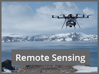
The SCAR Action Group on Remote Sensing was established at the XXXII SCAR Meeting in Portland 2012 with the full name “Development of a satellite-based, Antarctic-wide, remote sensing approach to monitor bird and animal populations”, initially for a period of three years, with the aim of addressing the topic of “Animal monitoring via remote sensing”. A number of publications on that topic, several published in 2012, indicated that the importance of satellite-based remote sensing for monitoring purposes was growing. In these various publications, different methodological approaches were proved and discussed
A working meeting of the Remote Sensing group was held during the XIth SCAR Biology Symposium on 19 July 2013 in Barcelona, and followed by a meeting and symposium at the XXXIII SCAR Meeting in Auckland 25 August 2014. Important points discussed included relevant databases for collecting penguin (and other seabirds and seals) abundance data, collected with remote-sensing methods, rules for using drones (UAV) over penguin colonies and continued discussions about new satellite technologies.
The group also met at the XIIth SCAR Biology Symposium in Belgium (2017) and the SCAR/IASC Conference in Davos (Switzerland) 2018.
The Remote Sensing AG aimed to focus on future developments in a number of multi-disciplinary research fields, including new and emerging research frontiers in Antarctic science:
- Recent technology in geospatial science over the last decade motivated major advances in our understanding of the Antarctic continent and surrounding oceans. These developments included the use of new satellite remote sensing platforms (e.g. WorldView and Landsat series of satellites) and methods to obtain geospatial information, such as automatic/semi-automatic extraction of information from remote sensing images, new mapping techniques for ice sheet properties (roughness, thickness and velocity), usage of remotely sensed data for Antarctic glaciological and mass balance studies, and ice sheet flow and geodynamics over short temporal scales.
- Remote sensing of the marine cryosphere (including sea ice and its snow cover) and its interactions with ocean and atmosphere and generation of digital elevation models (DEMs) of Antarctic regions.
- Rapid developments in monitoring bird and seal populations and habitats with remote sensing applications using unmanned aerial vehicle (UAV), including disturbance capability and environmental impacts of UAVs on bird and seal populations.
- The use of Autonomous Underwater Vehicle (AUV) technology to investigate small-scale characteristics and changes. Much of this research is cross-disciplinary in its nature and this has led to noteworthy advances across a range of Antarctic scientific disciplines.
The group aimed to merge snow and ice studies with climate research, ice-ocean interaction, and animal monitoring via remote sensing.
The Co-Chairs of the Remote Sensing group were:
Hans-Ulrich Peter (Polar and Bird Ecology Group, Jena University, Germany)
Osama Mustafa (Think, Jena University, Germany).
Other members of the group included:
- Heather Lynch (Stony Brook University, USA)
- Michelle La Rue (University of Minnesota, USA)
- Peter Fretwell (British Antarctic Survey, UK)
- Ewe Hong Tat (Universiti Tunku Rahman, Malaysia)
- Shridhar Jawak (National Centre for Polar and Ocean Research, India)
- Rob Massom (Australian Antarctic Division, Australia)
- Oscar Schofield (Rutgers University, USA)
- Mathew Schwaller (NASA Goddard Space Flight Center, USA)
- Malgorzata Korczak-Abshireb (Polish Academy of Sciences, Poland)
- Paul Morin (Polar Geospatial Center, USA)
- Marie-Charlott Rümmler (Jena University, Germany)
- Barbara Bollard Breen (Auckland University of Technology, New Zealand)
The Remote Sensing group merged with the Earth Observation Action Group in 2021.
SERAnt
The SERAnt Action Group (Sun Earth Relationships and Antarctica), active from 2014 to 2016, aimed to quantify the effects of the solar activity on the near-Earth environment (GeoSpace) and the planet’s geomagnetic, plasma, and atmospheric domains.
It was formed in 2014 to replace ICESTAR and its purpose was to determine the Terms of Reference for a Task Group on solar terrestrial physics, leading to representation within the Physical Sciences Group of the research effort in Antarctica that aims on quantifying effects of the solar activity on the near-Earth environment (Geospace) and the planet’s geomagnetic, plasma, and atmospheric domains.
The SERAnt group was chaired by Allan Weatherwax, with Andrew J Gerrard, Annika Seppälä and Giorgiana De Franchschi on the team. Those involved in the formation of the group in 2014 were: Dr Maurizio Candidi, Dr Giorgiana DeFranceschi, Dr Annika Seppala, Dr Monica Laurenza. Dr Alessandro Damiani, Dr Ilja Usoskin, Prof Kazuo Shiokawa, Prof Umberto Villante, Dr Craig Rodger and Dr Allan Weatherwax.
The group ended in 2016 and its work was taken on by GRAPE (GNSS Research and Application for Polar Environment).
Proposed SERAnt research fields
Implementation plan
- Actions to bring together presently available data, including harmonisation of data formats, also considering the provisions of the SCAR data specialists;
- Planning for integration of resources, coordinating observation plans, defining time intervals for joint studies;
- Coordinated presentation of Antarctic results at disciplinary meetings, and at SCAR Open Science Conferences;
- Due attention will be devoted to the efforts of GRAPE to establish a task force for the SRP proposal on which the URSI Commission G and SCAR-GRAPE communities agreed at the URSI AT RASC meeting 2015. Representatives from other communities (e.g. SuperDARN) will be involved in the task force as well as SERAnt.
Time frame
The group will act for four years, starting in Kuala Lumpur 2016, and will coordinate with GRAPE, the leading task force devoted to the preparation of a Scientific Research Programme that will be presented and discussed during the SCAR OSC in Kuala Lumpur 2016. This is in response to one of the six SCAR Horizon Scan priorities, namely “the near Earth space and beyond”. Horizontal coordination between the SRP with other programmes of interest are envisaged (e.g. SCOSTEP’s VarSITI, 2014-18).
Further details are given in the SERAnt Proposal.
Terms of Reference
In 2014 the SERAnt Action Group was established to determine the Terms of Reference for an Expert Group on solar terrestrial physics, with the following objectives:
- Identify the science to be addressed, and the groups worldwide that are already active in research in the field;
- Formulate a proposal for its structure and composition;
- Analyze the interaction with GRAPE EG and avoid duplication, while promoting synergy; and
- Bridge over gap between ICESTAR, closed at Auckland, and future EG to be formed in Kuala Lumpur.
Selected papers:
- Intermittency on simultaneous observations of riometer at several Antarctic locations, EM Ovalle, AJ Foppiano, MV Stepanova, AT Weatherwax Advances in Space Research 57 (6), 1338-1344
- Further evidence for a connection between auroral kilometric radiation and ground level signals measured in Antarctica
J LaBelle, X Yan, M Broughton, S Pasternak, M Dombrowski, … Journal of Geophysical Research: Space Physics 120 (3), 2061-2075 - GPS phase scintillation at high latitudes during geomagnetic storms of 7–17 March 2012–Part 2: Interhemispheric comparison
P Prikryl, R Ghoddousi-Fard, L Spogli, CN Mitchell, G Li, B Ning, … Annales Geophysicae 2015
SnowAnt
The Action Group for Snow in Antarctica (SnowAnt) was established in 2014 and aimed to improve the knowledge on depositional and metamorphic processes in Antarctic snow and its feedbacks to the climate system; to develop a snow classification for Antarctica; to protect pristine snow areas, and to implement a database to document disturbed areas, historic snow profiles, accumulation data from AWS, stake farms, surface radar profiles, shallow firn–snow cores.
Over the period 2014 to 2016, SnowAnt activities were twofold: organization of Snow in Antarctica specific sessions at EGU 2016 (merged due to too few participants) and SCAR-OSC 2016. The other activity was the organization of the annual Snow Science Winter Schools, which brought about 50 students in contact with SCAR, and provided a sound background on modern methods in snow analysis:
- 1st European Snow Science Winter School, Sodankylä, Finland (2015)
- 2nd Snow Science Winter School Preda and Davos, Switzerland (2016)
- 3rd Snow Science Winter School, Sodankylä, Finland (2017)
- 4th Snow Science Winter School, Col du Lautaret, France (2018)
Significant progress has been made in recognizing snow as an important element of Antarctica, as demonstrated by successfully setting up a specific snow session for OSC 2016. However, it is extremely difficult to get researchers motivated to work for the very long-term objectives of SnowAnt.
For the period 2016 to 2018, the key initiative was to find additional active members for the Action Group. This was done by more actively promoting the topic within the Snow Science Schools and in other snow related conferences.
Collaboration with the Action Group on Geological Heritage and Geo-conservation (Geoconservation) was discussed during the OSC 2018. The goal of this collaboration is to use the knowledge with respect to the goals of protecting pristine snow areas and have the issue taken up by Antarctic Treaty member states.
The chair of the group was Martin Schneebeli of the WSL Institute for Snow and Avalanche Research, Davos, Switzerland. Other members of the group included Katherine Leonard (École Polytechnique Fédérale de Lausanne), Willem Jan van de Berg (Utrecht University), Ludovic Brucker (NASA Goddard Space Flight Center), Alexey Ekaykin (Russian Arctic and Antarctic Research Institute), Lora Koenig (National Snow and Ice Data Center) and Marcel Nicolaus (Alfred-Wegener-Institut).
Terms of Reference
The key goals for SnowAnt were to:
- Investigate: Improve the knowledge on depositional and metamorphic processes in Antarctic snow and its feedbacks to the climate system; develop a snow classification for Antarctica.
- Protect: What is disturbed today will be in the ice core for the next ~1 My – preserve pristine snow areas; currently disturbed areas have to be mapped and coordinated with national logistic operators.
- Implement: SnowREADER (database) to document disturbed areas, historic snow profiles, accumulation data from AWS, stake farms, surface radar profiles, shallow firn – snow cores.
- Educate and Coordinate: Quantitative snow stratigraphy methods developed by the IACS working group MicroSnow should be implemented by snow schools; recognize the importance of snow for SCAR.
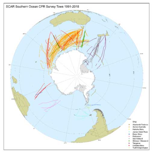
SO-CPR
The Southern Ocean Continuous Plankton Recorder Database (SO-CPR) was initially established to assist the development and expansion of the CPR research in the Southern Ocean and Antarctic waters. The group’s work also focused on the Quality Assurance and Quality Control (QA/QC) of the data and maintaining the highest methodological standards in CPR sampling and taxonomic methodology across the SO-CPR Survey laboratories.
The SCAR Southern Ocean Continuous Plankton Recorder (SO-CPR) Survey was established in 1991 by the Australian Antarctic Division to map the spatial-temporal patterns of plankton biodiversity and use the sensitivity of plankton to environmental change as early warning indicators of the health of the Southern Ocean. In 2008, the SCAR Continuous Plankton Recorder Expert Group (EG-CPR) was established to assist the development and expansion of the CPR research in the Southern Ocean and Antarctic waters.
The original terms of reference for the Continuous Plankton Recorder Expert Group (EG-CPR) were to:
- Map the biodiversity and distribution of plankton, including euphausiid (krill) life stages, in the Southern Ocean.
- Use the sensitivity of plankton to environmental change as early warning indicators of the health of Southern Ocean, by studying spatial-temporal variation in plankton patterns.
- Serve as reference on the general status of the Southern Ocean for other monitoring programs.
- Develop and maintain the SO-CPR Database and to improve access for users.
- Expand and enhance the SO-CPR Survey to include more ships and repeat transects around Antarctica.
The EG-CPR had proved invaluable in helping the Southern Ocean CPR Survey becoming a high successful biological survey and monitoring programme with a near circum-Antarctic coverage. In turn, it has become an important source of data and information for other SCAR initiatives such as SCAR-MarBIN, the Census of Antarctic Marine Life (CAML) and the Southern Ocean Observing System (SOOS). The SO-CPR and EG-CPR were important foundation members of the Global Alliance of CPR Surveys (GACS) which places the Antarctic CPR data in a global context. During the term of the EG-CPR and its predecessor Action Group some 40 papers had been published.
In 2016, the transition of the existing EG-CPR to the Southern Ocean Continuous Plankton Recorder Database Expert Group (SO-CPR) was approved.
As a task of the EG-CPR of ten years, a special report on the “Status and Trends of Southern Ocean Zooplankton” was published as a SCAR Bulletin in June 2021. This report brought together all information from 25 years of the SO-CPR Survey into one report which identified trends (seasonal or long-term) in relation to changes in abundance, shifts in distribution, timing of events, or changes in composition and community composition.
The principal product of the SO-CPR survey was the production of a high quality dataset for purposes of mapping plankton biodiversity: monitoring and development of models at seasonal, inter-annual, decadal, and spatially local and global scales; and providing core plankton data for ecosystem models. New modelling methods have allowing the group to predict patterns of individual species or whole assemblages by modelling the relationship between plankton and remotely measured environmental variables. The analyses will assist in the study of environmental effects on plankton, predator-prey relationships, the identification of foraging zones, and assist fisheries and conservation management.
The SO-CPR Expert Group closed in 2024.
SO-CPR was chaired by Kunio Takahashi (National Institute of Polar Research, Japan). Other members of the group included:
- Graham Hosie (former Chair, Australia)
- Hans Verheye (South African Department of Environmental Affairs, South Africa)
- Julie Hall (National Institute of Water and Atmospheric Research (NIWA), New Zealand)
- Philippe Koubbi (Université Pierre and Marie Curie, France)
- Marianne Wootton (Sir Alister Hardy Foundation for Ocean Science (SAHFOS), UK)
- John Kitchener (Australian Antarctic Division (AAD), Australia)
- Ben Raymond Australian Antarctic Division (AAD) Australia
- Karen Robinson (National Institute of Water and Atmospheric Research (NIWA), New Zealand)
- Erik Muxagata (University of Rio Grande, Brazil)