The Scientific Committee on Antarctic Research (SCAR) is a thematic organisation of the International Science Council (ISC).

About us
 SCAR is charged with initiating, developing and coordinating high quality international scientific research in the Antarctic region (including the Southern Ocean), and on the role of the Antarctic region in the Earth system. The scientific business of SCAR is conducted by its Science Groups which represent the scientific disciplines active in Antarctic research and report to SCAR.
In addition to carrying out its primary scientific role, SCAR also provides objective and independent scientific advice to the Antarctic Treaty Consultative Meetings and other organisations such as the UNFCCC and IPCC on issues of science and conservation affecting the management of Antarctica and the Southern Ocean and on the role of the Antarctic region in the Earth system.
SCAR’s history looks back at six decades of successful international collaboration. Since its first meeting in The Hague on 3-5 February 1958, SCAR has grown an international network of thousands of scientists who share a common ambition to carry out Antarctic science for the benefit of society.
SCAR has made numerous recommendations on a variety of matters, many of which have been incorporated into Antarctic Treaty instruments. Foremost amongst these have been the advice provided for the many international agreements which provide protection for the ecology and environment of the Antarctic.
How we work
SCAR is very fortunate to have many volunteers who give their time to help guide the organisation and coordinate its activities. SCAR’s organisational structure and rules about the duties and responsibilities of SCAR’s members are laid out in our governance section. SCAR is registered as a Company and a Charity in the UK: Company Number 06564642; Charity Number 1124840.
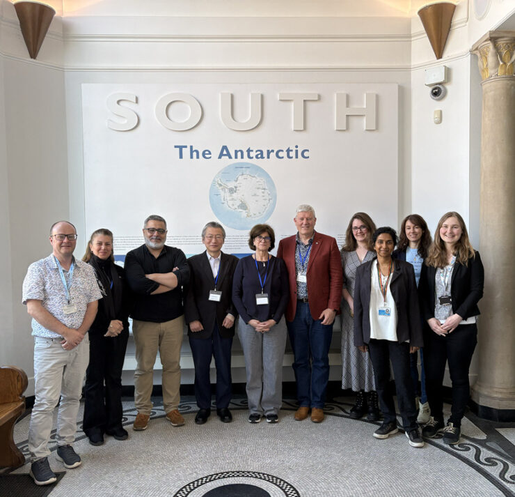
SCAR’s leadership comprises of the Delegates, which are appointed by the SCAR members and meet every two years at the SCAR Delegates’ Meeting to formulate SCAR policy and strategy. They also elect an Executive Committee from among themselves to manage SCAR on behalf of its members. The Executive Committee comprises:

The President

Vice President

Vice President

Vice President

Vice President

Immediate Past-President

The SCAR Executive Director
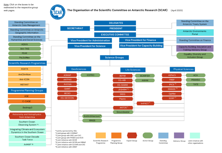
SCAR's Organisational Structure
SCAR also holds a major Open Science Conference leading up to the Delegates Meeting, to draw attention to Antarctic issues, and convenes meetings of the Science Groups to finalise the Science Programmes for Delegate approval.
The day-to-day administration of SCAR is the responsibility of the SCAR Secretariat, who is also responsible to the Executive Committee. It is based at the Scott Polar Research Institute in Cambridge, UK, and is staffed by the Executive Director, Executive Officer, Project Officer and Administrative Officer.
SCAR is committed to continuous improvement through review, assessment as to progress, and revision of its strategy as necessary. The SCAR Strategic Plan 2023-2028: Urgent Messages from the South: Antarctic and Southern Ocean Science and Policy focuses on the climate crisis and the role of SCAR as the leading scientific organisation on Antarctica.
As a thematic organisation of the International Science Council (ISC), SCAR supports and adheres to the principles and values of its parent body. The International Science Council promotes the idea that science is a common human endeavour that transcends national boundaries and is to be shared by all people. Scientific progress results from global exchange of ideas, data, materials and understanding of the work of others.
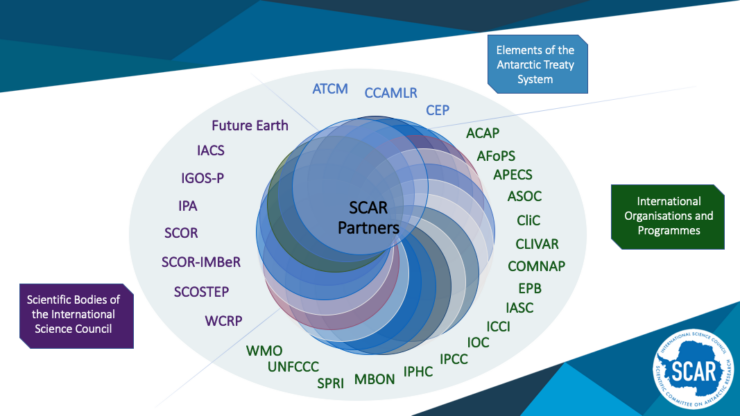 Partnerships with organisations with complementary skills, technologies and interests bring added value to SCAR’s activities. SCAR partners with ISC bodies, advisory bodies to the Antarctic Treaty System, organisations with a polar mission, and global programmes with polar interests.


12th SCAR Open Science Conference
The 12th SCAR Open Science Conference is heading to Oslo, Norway, 10–14 August 2026!

Support Us
Interested in contributing to SCAR?