The SCAR Antarctic Digital Database (ADD) is a seamless compilation of topographic data for Antarctica to 60°S. The ADD is the place to view, query and download topographic datasets such as the Antarctic coastline, contours and rock outcrop.
British Antarctic Survey (BAS) compiles, manages and distributes the ADD datasets on behalf of SCAGI, the SCAR Standing Committee on Geographic Information.
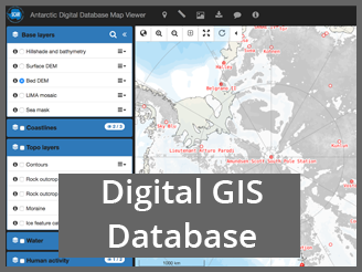
ADD datasets and data access
Visit the Antarctic Digital Database map viewer to visualise the available data. Data can be downloaded through the data catalogue in Geopackage or Shapefile format.
The datasets included in the ADD are:
- Coastline, including grounding lines and ice shelf fronts
- Rock outcrop
- Contours
- Lakes
- Moraine
- Streams
- Seamask
- ADD data limit at 60°S
All datasets are in WGS84 Antarctic Polar Stereographic projection, EPSG 3031.
Update frequency
Data updates occur on a six-monthly basis. The data was last updated on 12th May 2021.
Contributing to the ADD
The ADD is a service to the whole Antarctic science and logistics community, and as such we invite all users of the data to be active participants in improving its quality. Any inconsistencies can be reported via the web interface (the feedback button in the top navigation bar), or to the BAS Mapping Team. Similarly, any new or updated data from users are welcome for potential future inclusion in the ADD. Please also contact us if you have any questions about the ADD generally.
Licensing
Data are made available under the Creative Commons Attribution 4.0 International (CC BY 4.0) licence.
When using the data, please refer to the data catalogue for the required citation for each dataset.
Contact
Please get in touch with the BAS Mapping Team for any queries related to the ADD.